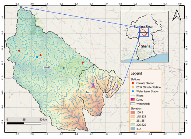
The Vea/Sissilli Basin collectively represents five (5) watersheds including the Vea, the Sissili, the Tono, the Atankwedi and the Anayare river basins. The basin which covers parts of northern Ghana and southern Burkina Faso is one of the three focal experimental catchments of WASCAL with Vea watershed (about 300 km2 in surface area) being its core research area. The basin comprises several wetlands, inland valleys, small dams (used for irrigation and animal watering) and wells/pumps resulting which makes it a complex ecosystem.
The climate of the basin is driven by West African Monsoon (WAM) and can be separated according to the WAM stages into a dry season (December to February), rainy season (July to September) and two transitional periods. Annual precipitation in the basin ranges between 800 mm and 1100 mm and originates largely from mesoscale convective systems. Therefore, precipitation amounts are characterized by a high spatiotemporal and multi-decadal variabilities. Land cover in the basin is undergoing rapid change exacerbated by increasing food demand of the considerably growing population of communities in the area.
The activities in this basin are coordinated by Mr. Samuel Guug (guug.s@wascal.org).