
The connection between wildlife conservation and climate change is undeniable with climate change posing significant challenges to wildlife populations around the world. These challenges range from habitat loss, altered ecosystems, and increased risk of extinction, to increased vulnerability to disease, to name but a few. Protecting wildlife and their habitats is not only crucial for biodiversity but also essential for climate change mitigation and adaptation.
Dedicated to addressing the challenges of climate change and enhancing the resilience of human and environmental systems in West Africa, digital innovation is key to WASCAL’s commitment to climate resilience and adaptation strategies.
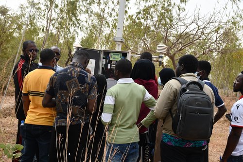
In that respect, the Data Management Division of WASCAL, based at the Competence Centre, in Ouagadougou, Burkina Faso, plays a central role. It hosts and manages a remote sensing GIS-LAB, an Internet of Things Lab, and a data infrastructure to deliver timely data services in support of climate and environmental services.
Data and remote sensing enable WASCAL, in its approach to tackling climate change and preserving wildlife, to monitor environmental changes, such as land cover and land use changes, deforestation rates, and habitat destruction. This approach includes research, innovation, and capacity-building efforts. Therein lies the importance of the School of Climate Change and Informatics located in Burkina Faso.
One of the key areas of focus for WASCAL’s Informatics and Climate Change Scholarship Programme is the use of technology and digital innovation to address climate change and environmental issues. Students learn how to use tools such as geographic information systems (GIS), remote sensing, and data analytics to collect, analyze, and interpret environmental data. These skills are essential for developing effective strategies for climate change mitigation and adaptation and consequently increase wildlife protection.
One of WASCAL’s key initiatives is the use of digital mapping technologies to monitor wildlife populations and their habitats. By utilizing tools such as web mapping, Leaflet JS, and OpenStreetMap, WASCAL creates detailed maps of parks and protected areas while involving the West African communities in the data collection process. These maps serve as valuable resources for researchers in informing decision-making and implementing effective strategies. Information is vital for assessing the impacts of climate change on wildlife populations and identifying areas that require conservation efforts.
In this same vein, apart from the generated reduction of carbon footprint, the automatization of wildlife protection, and the reduction of human error, digital innovation offers a range of benefits for wildlife conservation efforts, helping to improve, among others, data collection and analysis, monitoring and surveillance, community engagement, awareness raising and collaboration among organizations.
That’s why, to ensure a robust and coordinated effort, WASCAL recognizes that effective wildlife conservation requires collaboration across diverse partnerships. To this effect, WASCAL is in collaboration with some organizations well-versed in wildlife protection such as the International Union for Conservation of Nature (IUCN) to leverage expertise and resources to achieve common climate adaptation and mitigation as well as nature conservation goals.
By
WASCAL Communications